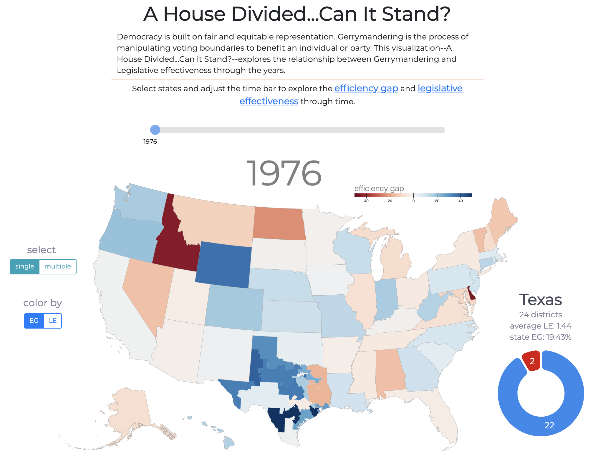
Democracy is built on fair and equitable representation. Gerrymandering is the process of manipulating voting boundaries to benefit an individual or party. This visualization--A House Divided...Can it Stand?--explores the relationship between Gerrymandering and Legislative effectiveness through the years.
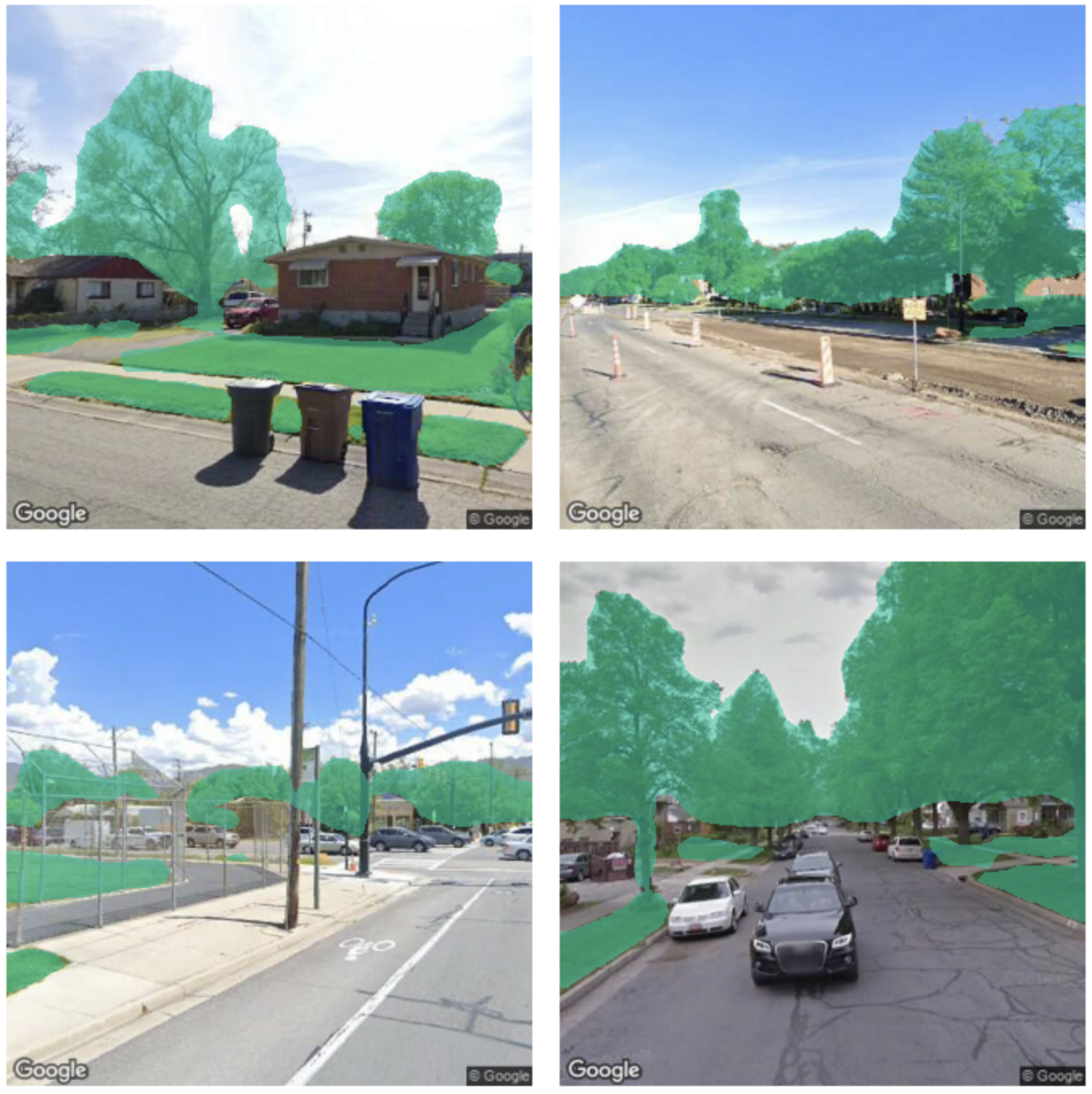
This project aims to quantify the amount of green space present in urban scenes using deep learning. Green space is associated with increased health and well being of urban residents, improved urban landscape quality, and the promotion of sustainable lifestyles. Thus, it is useful for urban planners to have an accurate picture of the distribution of green space throughout a city. We use semantic image segmentation to accomplish this task.
A multi-network visualization and interactive tool for the power grid + bus transportation system in Park City, Utah.
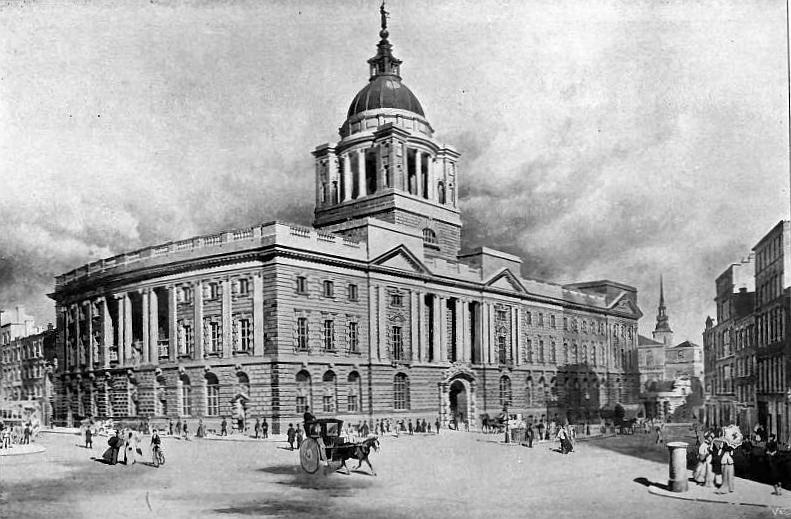
The Old Bailey is the colloquial name for the Central Criminal Court of England and Wales, which deals with with major criminal cases in Greater London, and also sometimes from the rest of England and Wales. Since all the text of the trials from 1674 to 1913 are available, we can ask the following text classification question: Can we predict the decision of the court using the transcribed dialogue during a trial? The goal of this project is to explore classifiers that predict the outcomes of trials. Final leaderboard standing: #2/103.
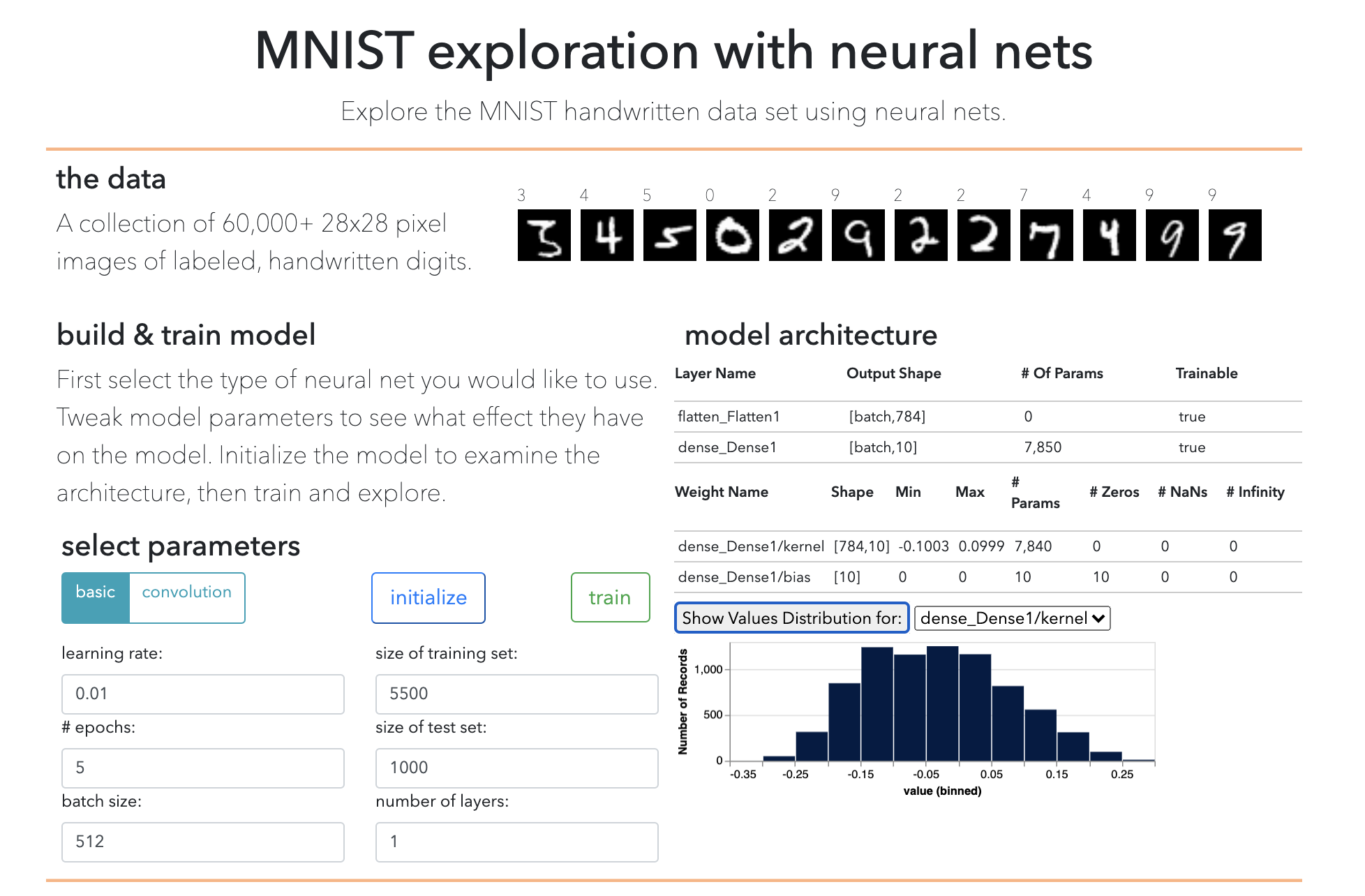
An web-based visualization of neural networks. Users can train a custom network on the MNIST dataset, visualize different features of the networks and observe the networks make real-time predictions as digits are drawn in the browser.
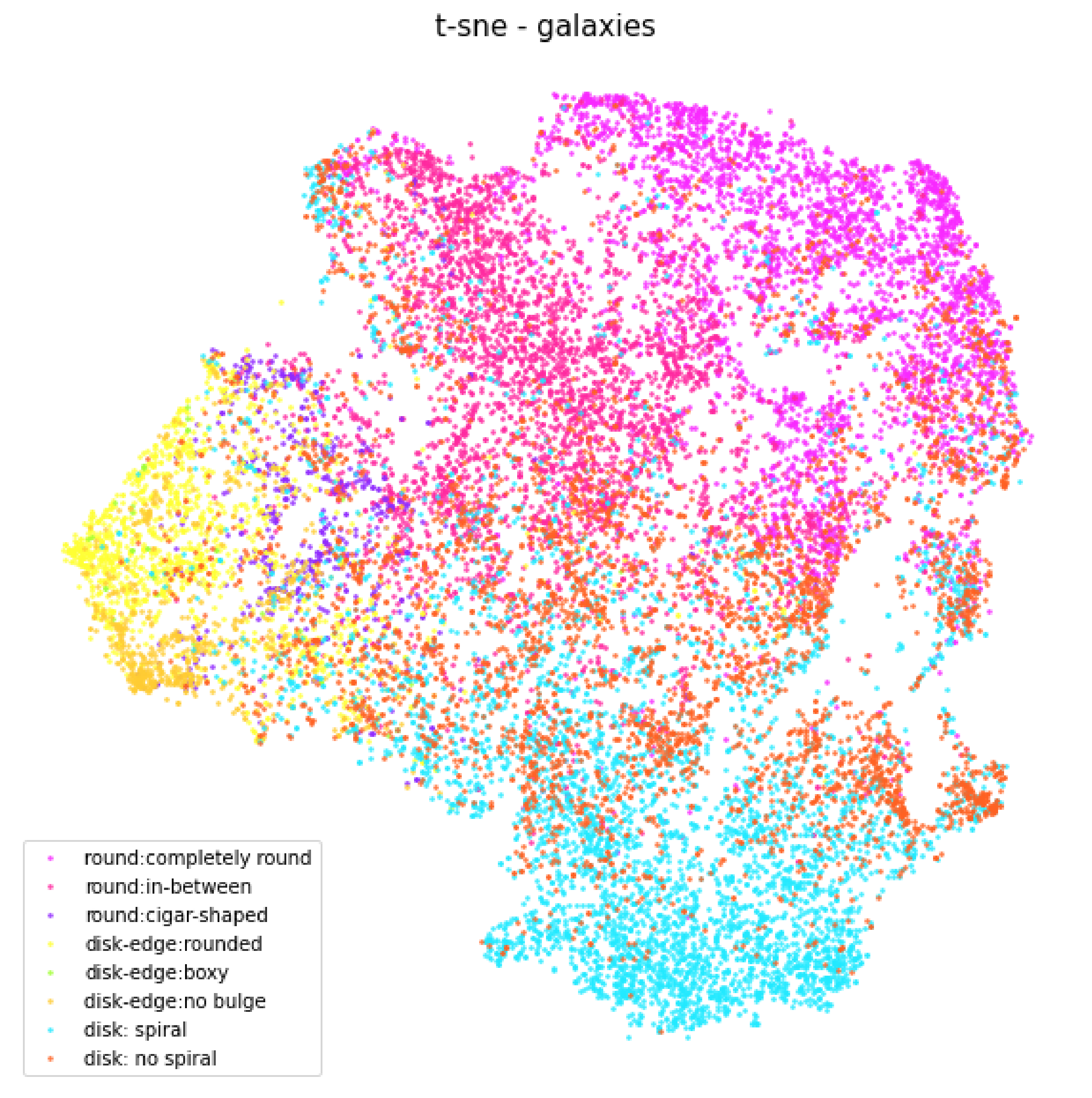
An exploration (through dimensionality reduction and clustering) of the features learned in a CNN trained on crowd-source-labeled galaxy images.
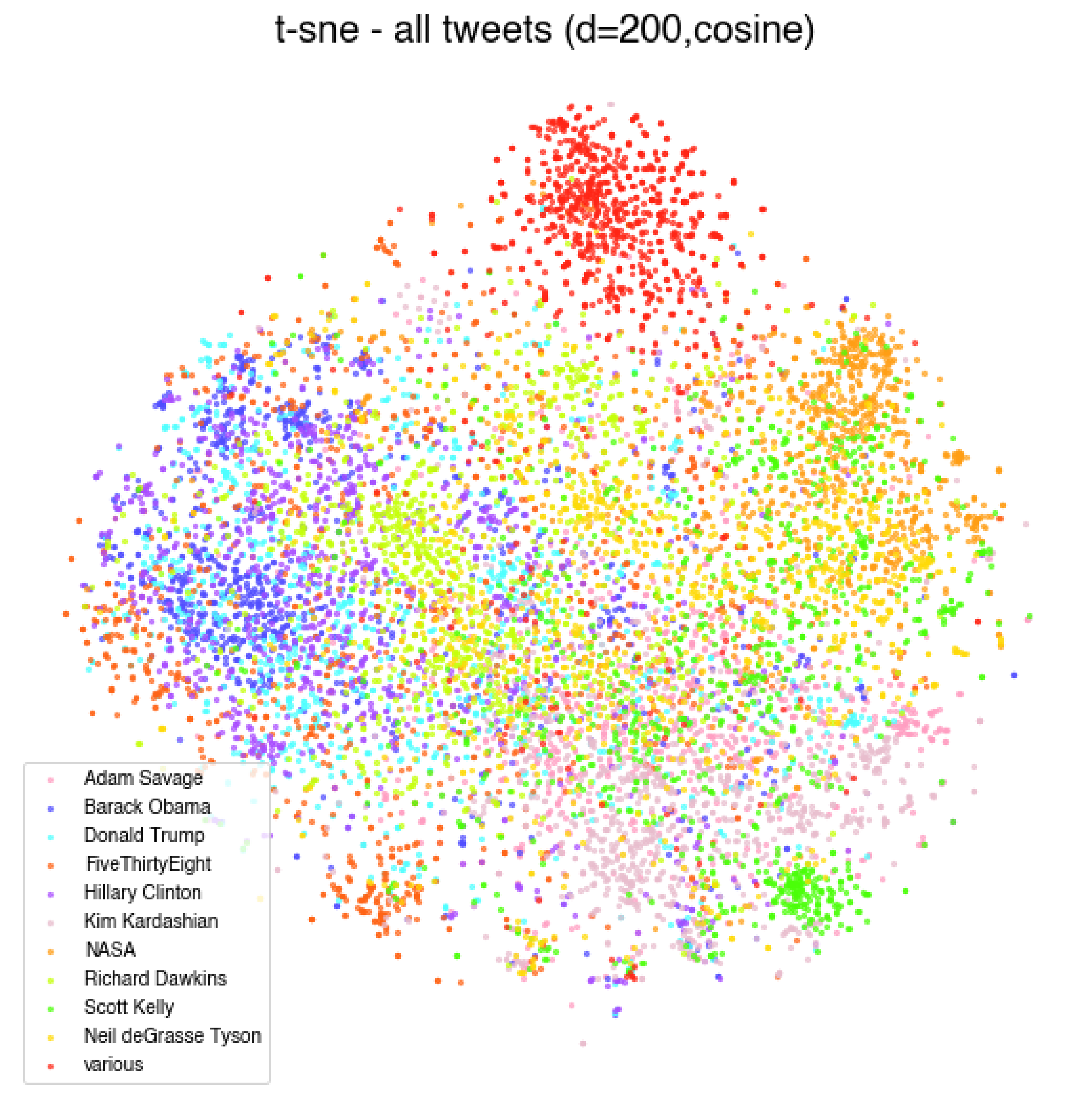
Exploring the relationships between tweets using dimensionality reduction and clustering.